Maps and the Timeline of Explorer History
1889--Jacob Brower makes a six month survey of the Lake Itasca basin, and concludes that the ultimate source of the inflowing waters of the Mississippi River springs from the "Greater Ultimate Reservoir" of DeSoto Lake and its environs, south and west of Lake Itasca. This would push the ultimate source even further south of Nicollet's surveyed source. Although Brower acquiesced to state pressure to designate the north end of Lake Itasca as the official headwaters, he notes that the longest distance a falling raindrop would travel from the Itasca basin to the Gulf of Mexico would originate much further south at Lake Desoto. Brower then lobbies for the establishment of a state park to protect Lake Itasca, and becomes the first Commisioner of the park in 1891.
1881--Civil War hero Willard Glazier travels to northern Minnesota and enlists Ojibwe guide Cheno-Go-Wesic to aid his travel to the Itasca basin. Glazier examines the large lake south of Itasca and names it Lake Glazier, proclaiming it to be the True Source, then becomes the first person to paddle a canoe from the Headwaters all the way to New Orleans. This lake, now named Elk Lake, lies at an elevation of only three feet about Lake Itasca, to which it is connected via Chambers Creek and a channel of marsh and bog. It is likely that at the time of Nicollet's survey, a higher water level on both lakes made them contiguous, and that what is now Elk Lake was merely a bay of the larger Lake Itasca.
1872--Julius Chambers notes that Elk lies south of Itasca, connected to it by what is now known as Chambers Creek. Despite his observations, he didnt get credit for his findings until he published his expedition memoirs nearly 40 years later, in 1910, by which time the question of the location of the "True Source" of the Mississippi River had already been officially decided.
1875--On behalf of the US government, Edwin S. Hall surveys the timber resouces of the Lake Itasca region, and in surveying the land by default also produces the first accurate map of Lake Itasca and surrounding bodies of water.
1865--Henry David Thoreau, having witnessed the destruction of the primeval white pine forests of his beloved New England Maine and, takes an interest in the preservation of Minnesota forests, and travels to St Paul. Intending to follow the Mississippi River to its source, he instead succumbs to his chronic battle with TB and returns home, where he died soon thereafter. Thoreau in Minnesota
1836-- French scientist and mapmaker Joseph Nicollet travels to Minnesota territory on a mission to investigate Schoolcraft's claim of the river's source at Lake Itasca. He is the first to survey the region with scientific instruments to determine latitude and longitude and elevation and fully investigates several tributaties into Lake Itasca, pushing the designation of the "True Source" several miles south of Itasca. His survey of the Mississippi River basin in the upper Midwest continued for several years, resulting in the first accurate hydrographic map of the region
1832-- Henry Rowe Schoolcraft and Lt James Allen and their crew are led to Lake Itasca by the Ojibwe leader Ozawindib. Schoolcraft claims the north end of Itasca as the source of the Mississippi, and Lt. Allen drafts a map of the lake and submits an official report to the U.S. Congress.
Italian adventurer Giacomo Beltrami comes to America, at first intent on trekking through and exploring the great American prairies. He is re-directed after a fortuitous encounter while travelling by steamboat to St Louis--both Governor William Clark of Missouri, and Captain Lawrence Taliaferro were travelling with him, and encouraged to journey north instead, to see if he could find the Headwaters of the Mississippi. Beltrami follows Taliaferro to his posting at Fort Snelling, then accompanies Major Stephen Long up the Red River til he came to the mouth of the Red Lake River. Continuing east on his own, he made his way to Red lake, where he received directions from the Ojibwe for finding the Continental Divide and the source of the Turtle River, now considered the northermost tributary of the Mississippi. Beltrami proclaimed the "True Source" to be at Lake Julia, at the head of the Turtle River. Beltrami's expedition report
Governor Lewis Cass and Indain agent Henry Schoolcraft head west from Michigan in the summer of 1820, bound for the Rainy River and lake of the Woods, in the vicinity of where they think the headwaters of the Mississippi may lie. Inspired by rumors of copper along the shores of Lake Superior, they are also eager to look for economic resources of the "Northwest Territory." The pair encounter William Morrison who is travelling from Fond du lac to Michilmacinac for a fur company meeting; when Morrison encounters Lewis Cass and the young Henry Schoolcraft, he redirects them to the St Louis River and gives them directions to find the Headwaters after traversing the Savanna Portage to the Mississippi .
Having been passed over in the selection of Lewis and Clarkes entourage, Zebulon Pike is allowed an expedition of his own in 1805. Woefully unprepared for a winter's journey, he and his men barely make their way to Leech Lake and Cass Lake in February 1806. Though told by the fur company agent, Hugh McGillis, that winterer William Morrison could lead him further upstream along a network of tributaries, Pike decides not to risk the lives of his men in trekking further, and declares Leech Lake to be the "True Source' of the Mississippi.
1803--William Morrison, a fur post clerk at Grand Portage, is assigned a wintering post at Upper Wild Rice Lake, and travels there via the Mississipi River. He crosses to the lake via a portage located located 6 miles north of Itasca. During his 2 year post there, he travels often to the nearest larger fur post at Lac Travers (Bemidji) in order to replenish supplies and turn in furs traded for with the local Ojibwe trappers. He also claims to have visited Lake Itasca on several occasions, and describes exploring its five tributaries. After being re-assigned to Leech Lake for several years, he returns to his Headwaters post in the winters of 1811-1812. He later rises to the level of chief agent of the Fond du Lac region, and decades later retires to Montreal. .
British cartographer David Thompson is charged with mapping the Northwest territories of Canada in 1798 before he starts out, he travels by dogsled from Red Lake to Cass Lake along the upland portage that parallels the Turtle River; though he doesnt find the headwaters of the Mississippi, he believes it lies in the vicinity.
French fur traders are trapping and trading in the vicinity of Lac La Biche, now Lake Itasca, and give the lake a name that is french translation of the Ojibwe name, Omushkos, for Elk Lake. While they do not specifically publish a report that they recognize it as the headwaters of the Mississippi, Jacob Brower does later find the ruined foundation of their french fur post on Schoolcraft Island in Lake Itasca, which he states proves their presence dating back to 1750.
1680 --Father Louis Hennepin travels down the Illinois River from the Great Lakes, then north along the Mississippi to the location of present-day Minneapolis, where he encounters the Dakota at what they call "Minirara" (curling water) which he maps and labels as St Anthony Falls.
1541-- Spanish explorer Hernan de Soto is the first European explorer to encounter and cross the Mississippi River, in his overland journey from Spanish Florida to what is now Arkansas and Louisiana DeSoto's Expedition
1898 --Minnesota state geologist Newton Winchell examines the records and surveys and maps of all previous explorers, and agrees with Brower that the ultimate source of the headwaters is south of Lake Itasca. He makes a final pronouncement that it is a toss-up whether to consider Glazier's claim of Chambers Creek and Elk Lake as the "True Source," or Nicollet's claim of Nicollet Creek leading to the upper Nicollet Lake. While Elk Lake is a larger lake upstream from Itasca than the upper Nicollet Lake, the stream connecting Elk Lake is shorter than the Nicollet Creek, and drains from a lower elevation. Despite his official scientific pronouncement of 1899, which is correct from a geologic and hydrologic perspective, the State legislature votes to keep the official designation of Schoolcraft's proclaimed headwaters at the north end of lake Itasca-- in part because they had already appropriated funds for a park sign crediting Schoolcraft
1682 --From Montreal, Rene Rovert Cavelier sieur de La Salle travels through the Great Lakes to Lake Michigan, down the Illinois River to its confluence with the Mississippi River, then downstream from St Louis to the Gulf of Mexico. He plants a marker when he arrives at the river's outlet at the Gulf of mexico, and claims the entire territory for France.
From archaeologic evidence, as well as oral histories and legends of different present-day tribes, it seems that early Paleo-Indians followed the last of the retreating Pleistocene glaciers 10,000 years ago, meandering their way northward up the Mississipi River to the region of today's headwaters.
1673 French explorers Jacques Marquette and Louis Jolliet explore the Mississippi River at the confluence of the Wisconsin River
1904--after several years acting as assistant Park manager at Itasca State Park, Mary Gibbs is appointed head Park Commissioner and defies incursions into the park by lumber companies and poachers who are taking advantage of unclear park boundaries
1899 to 1908 -- The Minnesota Federation of Women's Clubs, led by Professor Maria Sanford of the University of Minnesota and Minnesota Forestry Commission delegate Florence Bramhall, form a conservation caucus to lobby for forest preservation, especially in the Mississippi Headwaters region. Their cause is championed by Teddy Roosevelt, who becomes president and advocates for new National Parks and National Forests. A "Chippewa National Park" is proposed, which would encompass the area from Lake Itasca to Cass Lake and Deer River, expanding the area of headwaters protection from the 30,000 acres at Itasca State Park, to over 4 million acres further downstream in the Headwaters region. Although legislation for this proposed National Park was defeated, Teddy Roosevelt and the Minnesota Women's Federation is credited for at least establishing the Chippewa National Forest, which protects 225,000 acres of forest around Cass Lake and Leech Lake.
Events have been experienced
and remembered differently
by different peoples;
there are facts, and
different interpretations of facts;
there are stories and story-tellers, and myriad legends that evolve through time,
all of which become part of
the rich tapestry of history.
The more facts we review, and
the more primary sources we examine,
the more we look backwards
through the lens of time,
the better able we are to forge new perspectives
that help us discover who we are today,
and how we got to where we are.
Later Pre-Columbian Woodland Indians established a trade network that spanned the length of the river, from mouth to source, trading ideas and goods with their neighbors along the way, and who, since ancient times, have recognized it as "The Great River" and "the Father of Waters."
Commissioned by Thomas Jefferson to survey America's newly acquired Louisiana Purchase, Lewis and Clark set out on a two year expedition to the Pacific Coast and back. Though they map the Missouri River watershed fairly accurately, their map shows minimal information on the upper Mississippi River as they did not traverse it. Later, in 1823, after William Clark has become the governor of Missouri and meets Italian explorer Beltrami travelling en route to St Louis, he encourages Beltrami to trek northward to fill in the gaps with new knowledge of the Mississippi Headwaters
The Woodland Anishinabe people begin The Great Migration westward into the what the Dakota call "Land of Sky-Tinted Water" (Minnesota), and map their journey on birchbark scroll maps. Anishinabe Migration story and Map
1498--Amerigo Vespucci sails past the Mississippi Delta and maps its location in the Gulf of Mexico' His mapped information is incorporated in Martin Waldsemuller's World Map of 1507, which was the first map to include the word "America" in honor of Amerigo Vespucci. Waldseemuller's map
French metis furtrader Jean-Baptiste Cadotte, Jr., is assigned to work the Fond du Lac territory, including Leech Lake, Cass Lake, and Red Lake, for the Northwest Fur Company. He is known to have travelled up the Mississippi as far as Cass Lake to an early assignment at the Red Lake furpost, and his supervisor Perrault claims that he explored the region of the Mississippi Headwaters in the process, though he published no maps or official documents to verify any specific claims of recognizing or pinpointing the river's source.
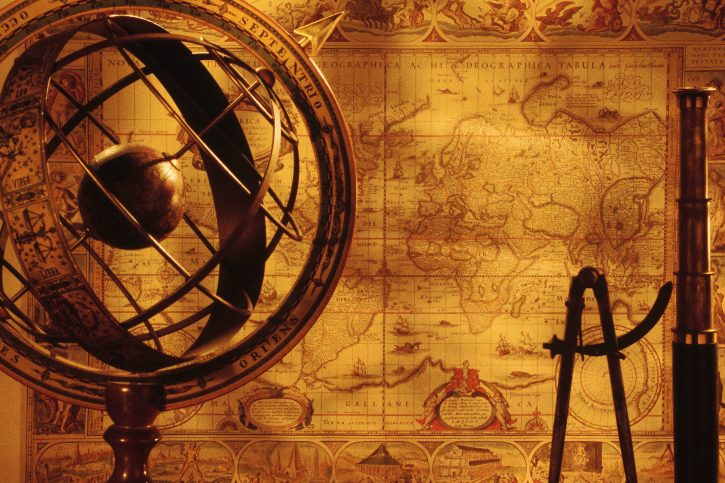
Italian mapmaker Coronelli drafts the first map which shows the Mississippi Headwaters region with a distinct river source. He includes it on his famous globe made in Florence, 1693. This globe was exhibited permanently in several places, including the court of Louis XIV and also in the library of Bergamo, northern Italy, where Giacomo Beltrami was born and studied in his younger years.
1866 Coloney and Fairchild Ribbon Map--"Father of Waters"
from David Rumsey Historical Map Collection http://www.davidrumsey.com/maps499.html
1899
1889
1881
1875
1872
1836
1832
1823
1820
1806
1804
1803
1798
1680
1682
1673
1541
1498
This page is still under construction.
Stay tuned as our journey through the past continues, and as we shed more light on our explorers stories!
900 AD
The more we study the past,
the more we realize that the history we thought we knew
is not necessarily carved in stone.
1904


1395
1395 -- Anishinabe people reach Madeline Island in Lake Superior. Anishinabe Migration story and Map
1545
1545--After hearing rumors of the arrival of Europeans on the shores of North America, some Anishinabe start to move further northward and westward into Minnesota, including into the region of the Mississippi Headwaters, displacing some of the Dakota who were living there at the time.

1861


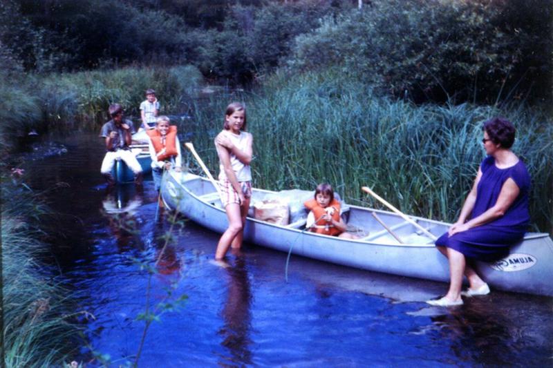
1967--Art Keenan, DNR Forester, surveys the Headwaters corridor and establishes the Minnesota DNR Headwaters Canoe Trail for public recreation. Outdoor explorers of all kinds are now able to launch their own canoes to explore the Mississippi River on their own, using newly established DNR campsites and canoe landings along the river corridor. The trip from Itasca to Bemidji is now a tame three to five day paddle.
1967


9000 to 8,000 BP
10,000 to 9,000 BP


1693
early 1700's
John Melish compiled the first map of the United States showing possesions from coast to coast. His first edition of 1816 used information from the expedition maps of Pike and Lewis and Clark. The 1823 edition also includes information from the Cass and Beltrami expeditions to update the Mississippi Headwaters region of the map
1816 -1823
1899-1908
Note: This page is still under construction.
Check back often to see what we add!

Publisher Matthew Carey designs numerous important maps of the United States and its territories, resulting in the First Atlas of America. He contracts with Lydia Steele Bailey to print his works. His 1814 atlas includes William Clark's Map of the Louisiana Territory
1814
Philadelphia printer Lydia Steele Bailey prints the first map of the entire inland waterways of the United States as known at the time. The map was sold on its own, and as an insert in Armroyd and Tanner's 1830 report to Congress on the current state of American navigation, also printed by Bailey. The map includes details of the Mississippi Headwaters based on the Pike and Cass expeditions, favoring Cass's designation as the source, and entirely dismissing Beltrami's northern Julian source. Inland Waterways map
1826 -1830

late 1700's
"The Source"
Educational
Resources
Resources for the modern day river explorer
Virtual Journey
to the Headwaters
River's Edge
Geographics
Our Cast of Characters
Explorer Expedition Timeline & Maps
MN Alliance for Geographic Education